
Curated Antique Maps & Old World Drawings
Timeless pieces, archival framed
Featured Items
Please review our Return Policy.
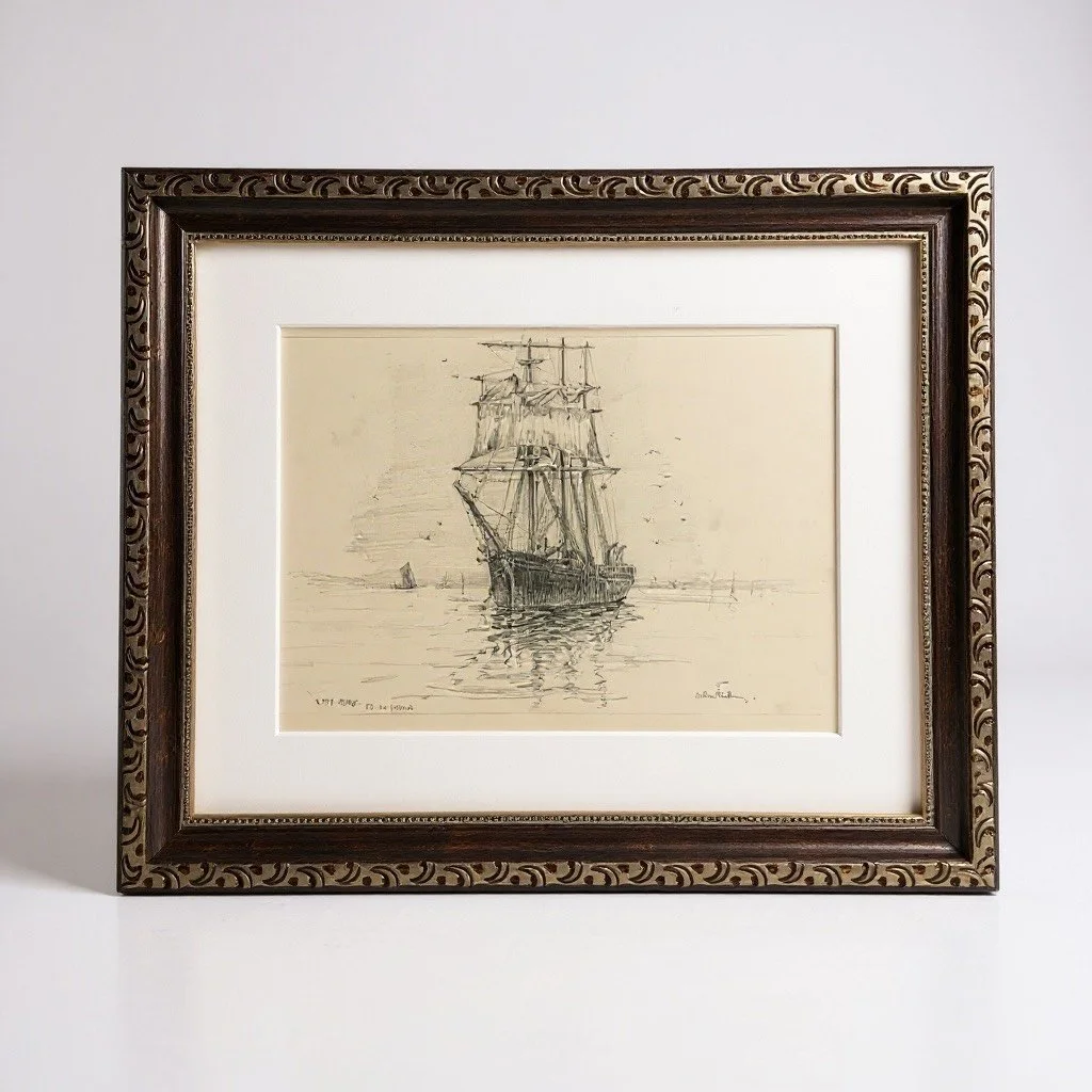
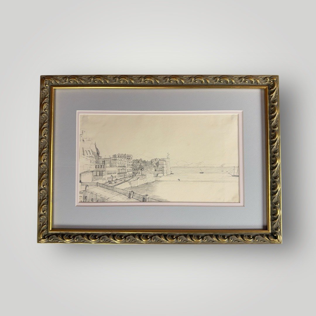
Artist: Arthur Ray Royce (1892-1977)
Approx. Dimensions (Framed): 14.75” × 12”
The Lady Quirk was a wooden sailing vessel with a remarkably long career spanning merchant trade, training, and wartime service. Originally launched as the Raymond in November 1876 and constructed by the shipbuilder Lefurgey in Prince Edward Island, Canada, she exemplifies the sturdy, multi-purpose ships of the late 19th-century sailing era.
As the Raymond, she carried cargoes such as coal and ore along transatlantic routes. Her registry in Swansea, Wales, during this period indicates significant involvement in the Welsh coal trade. In 1929, she was renamed Lady Quirk and underwent substantial alterations that extended her useful life well into the era of steam and motor vessels. From 1930 to 1934, she served as a cadet training ship based in Poole, United Kingdom. During the Second World War, she was taken into Royal Navy service, most likely as a reserve vessel for training or auxiliary duties.
Even by conservative estimates, Lady Quirk enjoyed one of the longest working lives of any wooden sailing ship constructed in the 19th century, remaining in service for approximately 70 to 75 years. She was eventually abandoned in her home port of Swansea between 1950 and 1955. Today, the decayed remains of her hull, consisting primarily of exposed ribs and framing, lie exposed like the skeleton of an archaeological site.
This delicate and atmospheric pencil drawing, signed by the artist, captures the Lady Quirk, during her final years of active service. The sensitive rendering of her graceful three-masted silhouette against the quiet waters perfectly evokes the twilight of the age of sail.
Please review our Return Policy.
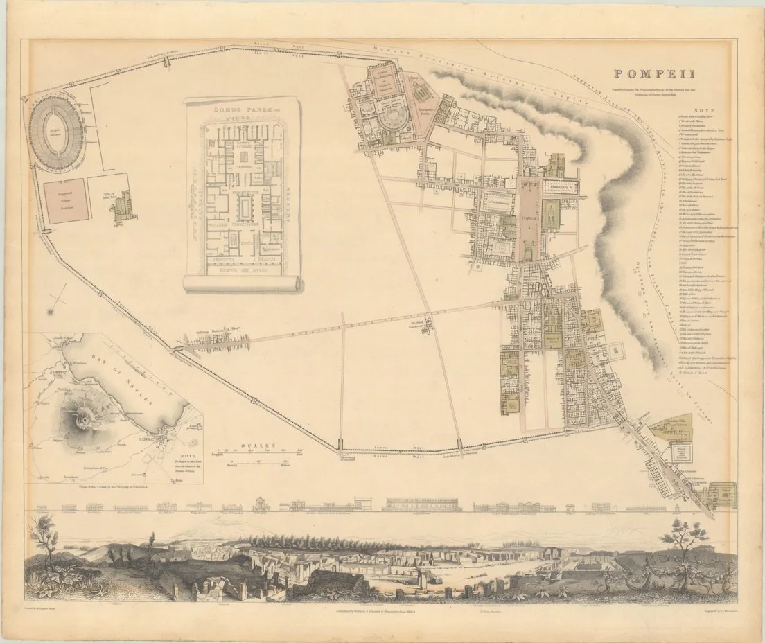
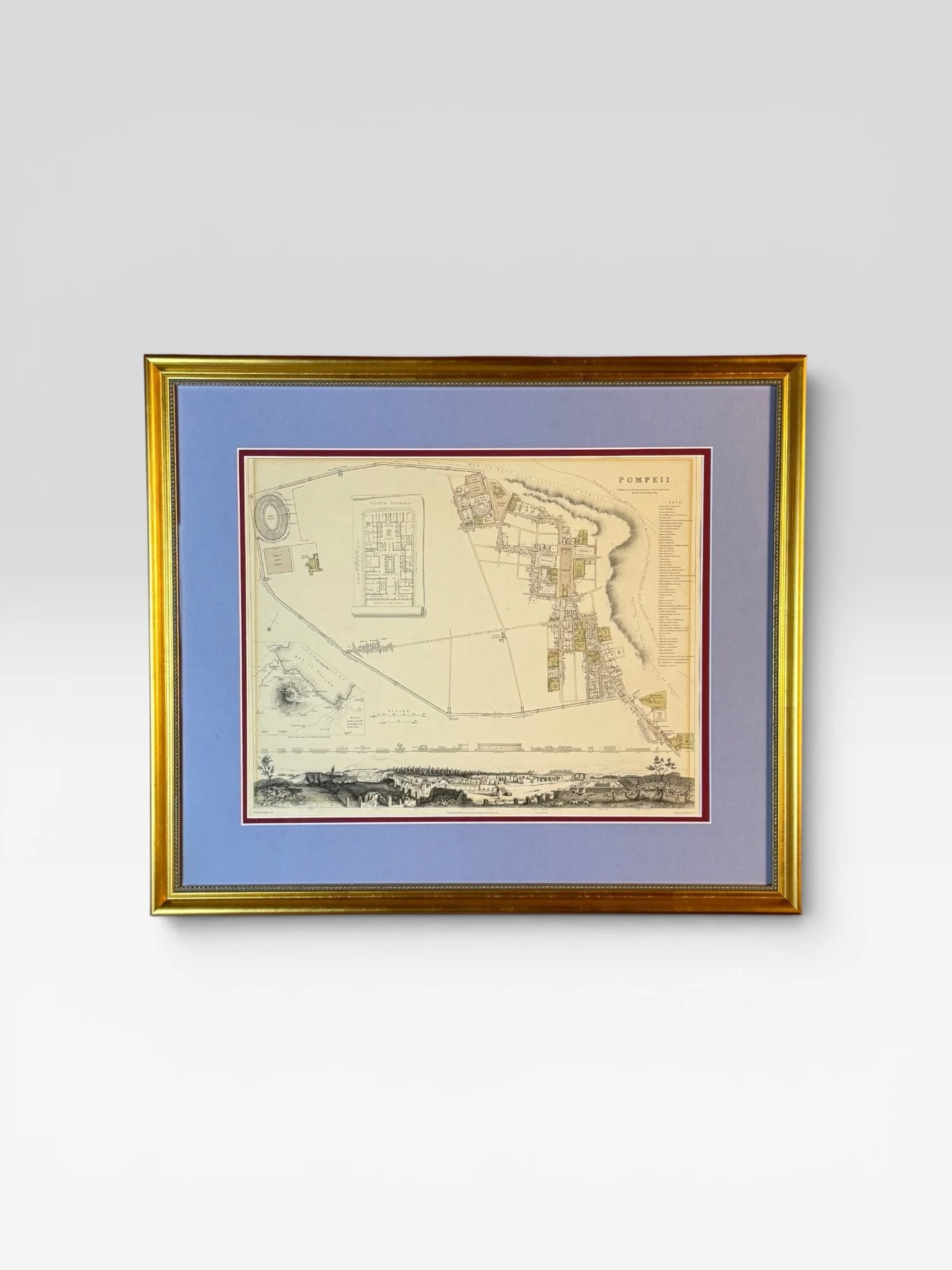
Title: “Pompeii”
Subject: Pompeii, Italy
Creator: SDUK Society for the Diffusion of Useful Knowledge
Date: 1832 (dated)
Map Size: 15.2 × 12.1 in | Framed Size: 22.25 × 19 in | Hand-colored
An exquisitely detailed plan of the ancient city of Pompeii as it appeared to early nineteenth-century eyes, freshly emerging from its entombment beneath the slopes of Vesuvius. Published in 1832 under the auspices of the Society for the Diffusion of Useful Knowledge by Baldwin & Craddock, and masterfully engraved by T.E. Nicholson, this cartographic work captures the wonder of one of archaeology’s greatest revelations. The key at the right carefully locates fifty-five principal buildings and monuments within the walled city. A finely rendered bird’s-eye view of the ruins, together with elevations of the major structures, graces the lower register, while elegant insets present a plan of the coast in the vicinity of Vesuvius and a detailed scroll rendering of the Domus Pansa, one of the most significant residences uncovered.
This beautiful example has been custom framed to museum standards in a solid wood frame with archival matting and foam-core backing. It is protected by premium UV-resistant acrylic glazing to safeguard against fading and environmental damage for generations to come. The refined blue matboard draws its inspiration from the vibrant cerulean tones of the Blue Room—a rare sacrarium recently excavated in Pompeii, its walls adorned with costly Egyptian blue frescoes depicting graceful female figures—thereby linking this nineteenth-century view of the ruins to the living artistic legacy still being uncovered today.
Pompeii, buried under thirty feet of volcanic ash and pumice during the catastrophic eruption of 79 AD, remained lost to history until its rediscovery in 1748. By the time this map was created, systematic excavations had already revealed a hauntingly preserved Roman city of streets, villas, temples, and theaters—offering an unparalleled window into daily life in the ancient world. This plan stands as both a precise scholarly document and a romantic evocation of classical antiquity, created at the height of the Grand Tour when European travelers flocked to witness the miracle of Pompeii for themselves.
Please review our Return Policy.
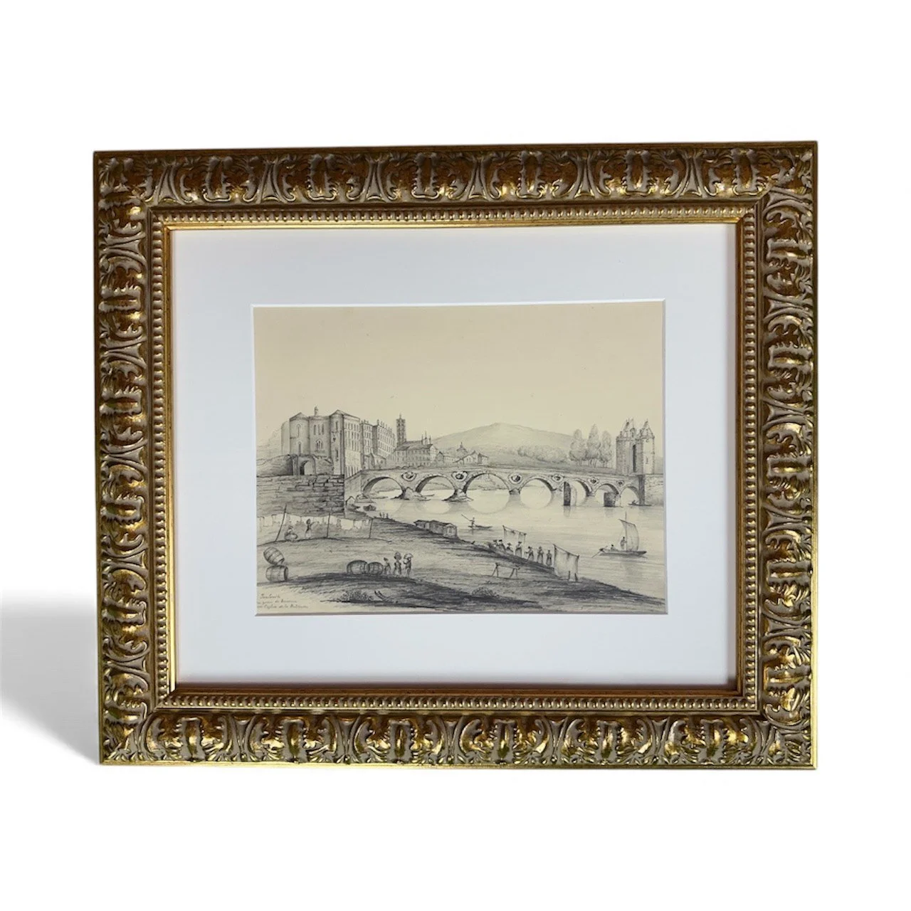
Approx. Dimensions (Framed): 20.25” × 17.5”
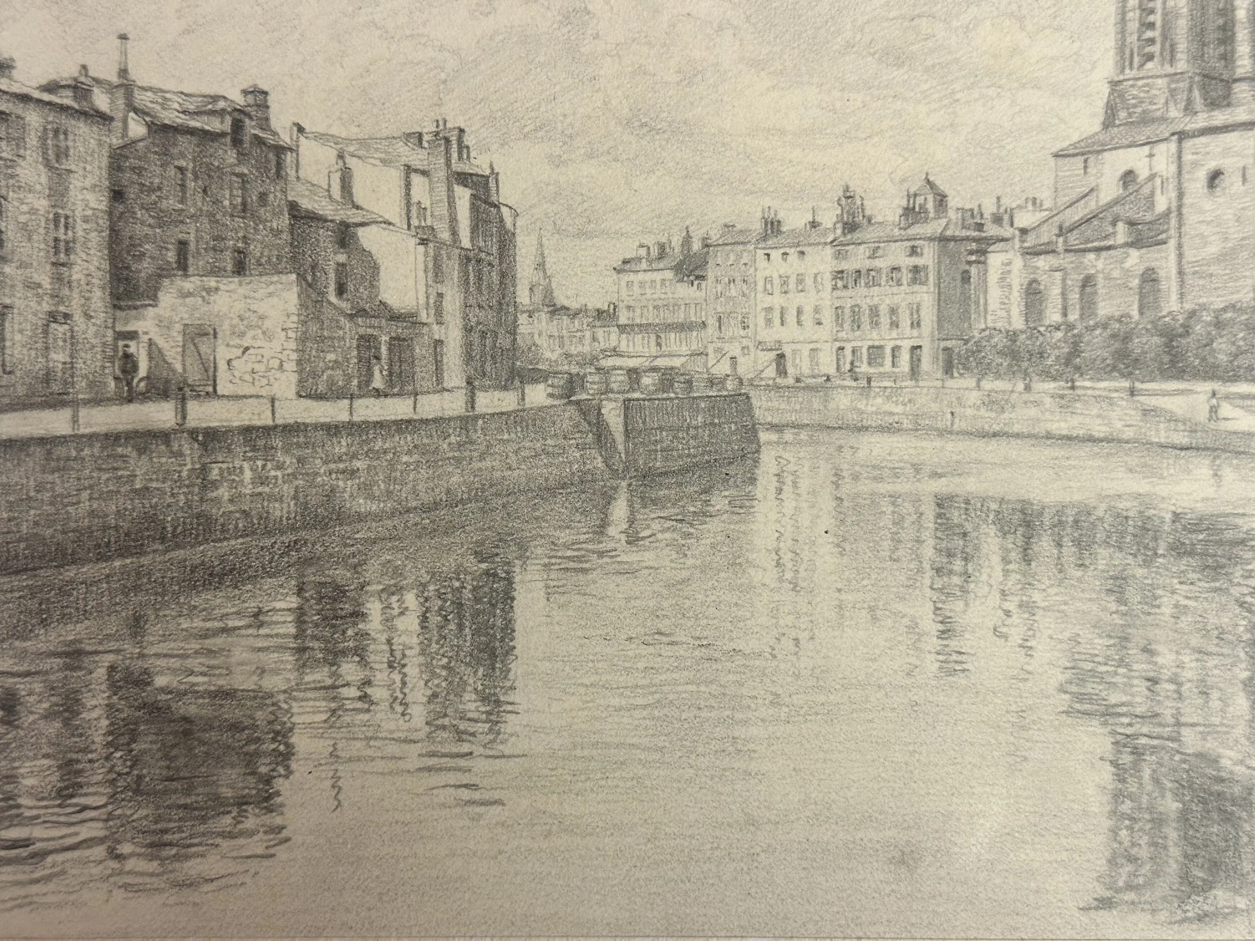
Artist: French School, 19th-century (Unsigned)
An extraordinarily vivid and minutely observed panorama of Toulouse at the very end of its age-old river economy. Executed with the precision of a master topographical draftsman, this large and luminous drawing captures the Pont Neuf – the city’s proud 16th–17th-century masterpiece – from the Saint-Cyprien bank on a calm day around 1838.
The composition is breathtaking in its breadth and microscopic detail: seven elegant brick arches with their famous oculus flood-relief openings frame the view toward the dense silhouette of the historic left bank. In the foreground, the gently sloping right-bank quay teems with the daily life that has now vanished: washerwomen beating and hanging laundry, and porters rolling enormous wine barrels.
Every figure, every ripple on the water, every brick course is rendered with a clarity and tenderness that rivals the finest works of the French romantic-realist school.
This is not merely a view of Toulouse; it is one of the most complete and atmospheric visual records of pre-industrial river life along the Garonne before the arrival of the railway.
Please review our Return Policy.
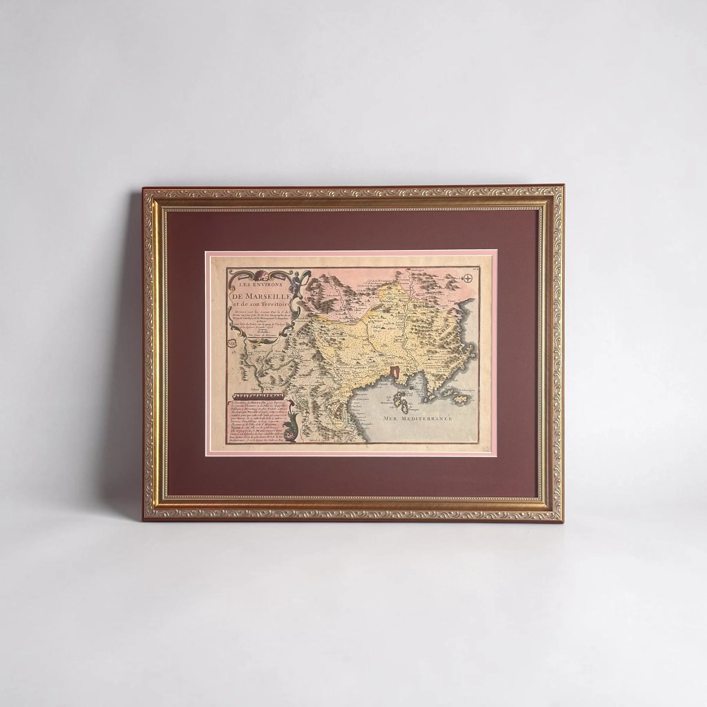
Title: “Les Environs de Marseille et de son Territoire...”
Map Creator: Nicolas de Fer
Date: 1708 (dated)
Map Size: 13.4 × 9.4 in | Framed Size: 21.75 × 17.25 in | Hand-colored engraving on laid paper
Source: Atlas Curieux…
This superb small map of the region surrounding Marseille offers a richly detailed and charming portrait of Provence’s greatest port and its hinterland at the height of Louis XIV’s reign. Created in 1708 by Nicolas de Fer, geographer to the King and the Dauphin, and published in Paris at the Sphere Royale, the map is filled with precise topographical information, villages, mountains, rivers, and coastal features. A decorative compass rose orients north to the left, while the map extends eastward to Aubagne and northward to the fortified city of Aix. Two large, ornate cartouches adorn the composition: a splendid title piece featuring allegorical figures, cannons, and maritime motifs, and a detailed legend cartouche describing the territory’s parishes and governance.
The hand-coloring brings the Provençal landscape vividly to life—the warm ochres and greens of the rugged hills and valleys, the soft pink wash of the Mediterranean, and the delicate outlines of the islands of Ratoneau, Tiboulen, and Pomègues lying just off the coast. Every detail reflects the artistry of early eighteenth-century French cartography, blending scientific observation with decorative elegance in the distinctive style of Nicolas de Fer’s celebrated works.
This beautiful example has been custom framed to museum standards in a solid wood frame with archival matting and backing, protected by premium UV-resistant glazing. The rich burgundy mat with its soft pink inner border elegantly complements the map’s warm hand-colored palette, creating a presentation of timeless sophistication and refinement.
A delightful addition to any collection of antique maps, Provençal history, or Mediterranean-inspired décor, this 1708 plan captures the enduring strategic and scenic allure of Marseille and its storied territory.
Museum-Quality Archival Framing
Acid-free matting and foam core backing for optimal protection against acidity and deterioration, ensuring your heirlooms remain pristine.
Custom solid wood frames, meticulously chosen for every framed piece to ensure timeless beauty and reliable support.
Premium archival acrylic glazing with advanced UV protection shields against fading, light damage, and environmental deterioration—preserving your priceless items for generations to come.