Please review our Return Policy.
Title: “Pompeii”
Subject: Pompeii, Italy
Creator: SDUK Society for the Diffusion of Useful Knowledge
Date: 1832 (dated)
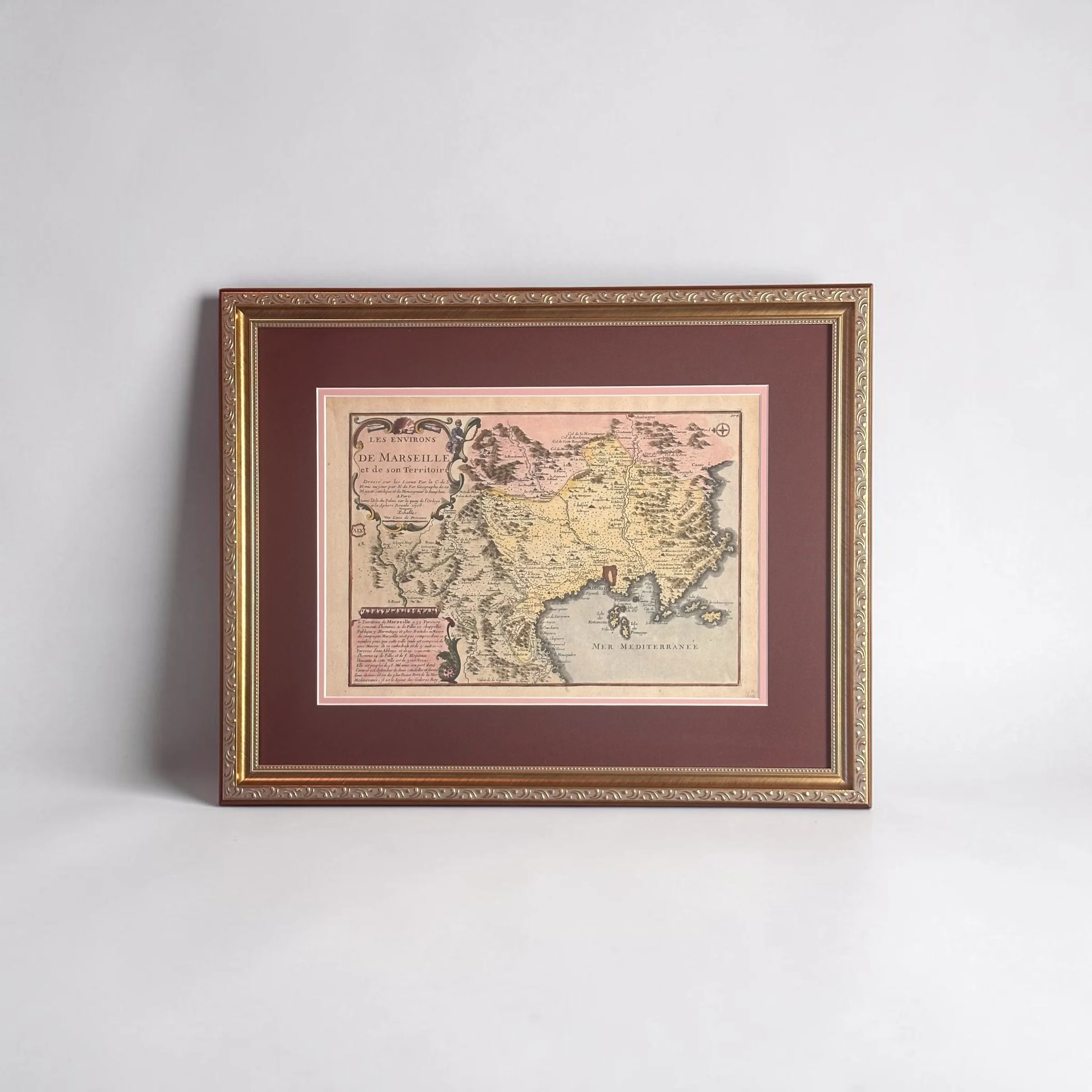
Map Size: 15.2 × 12.1 in | Framed Size: 22.25 × 19 in | Hand-colored
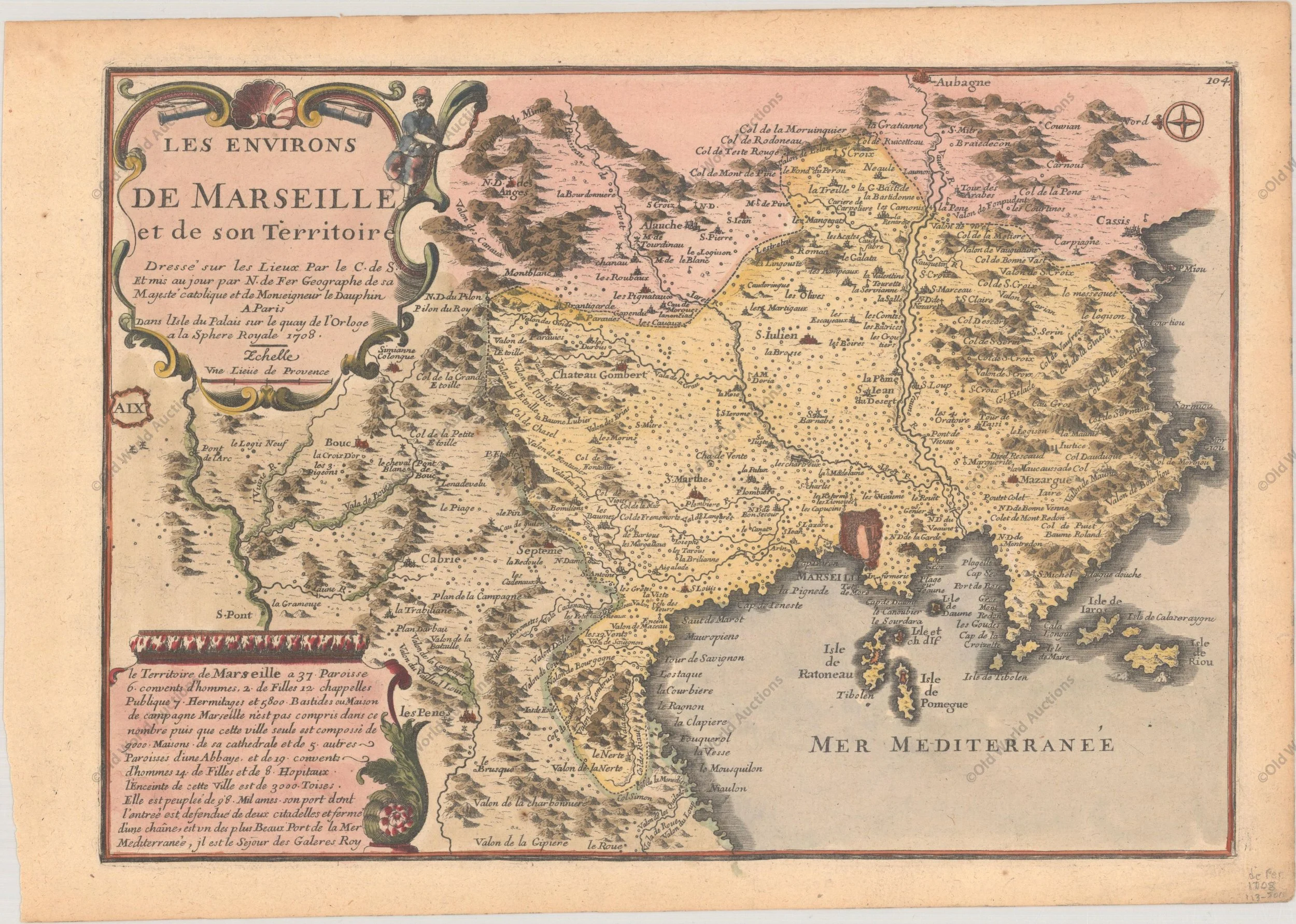
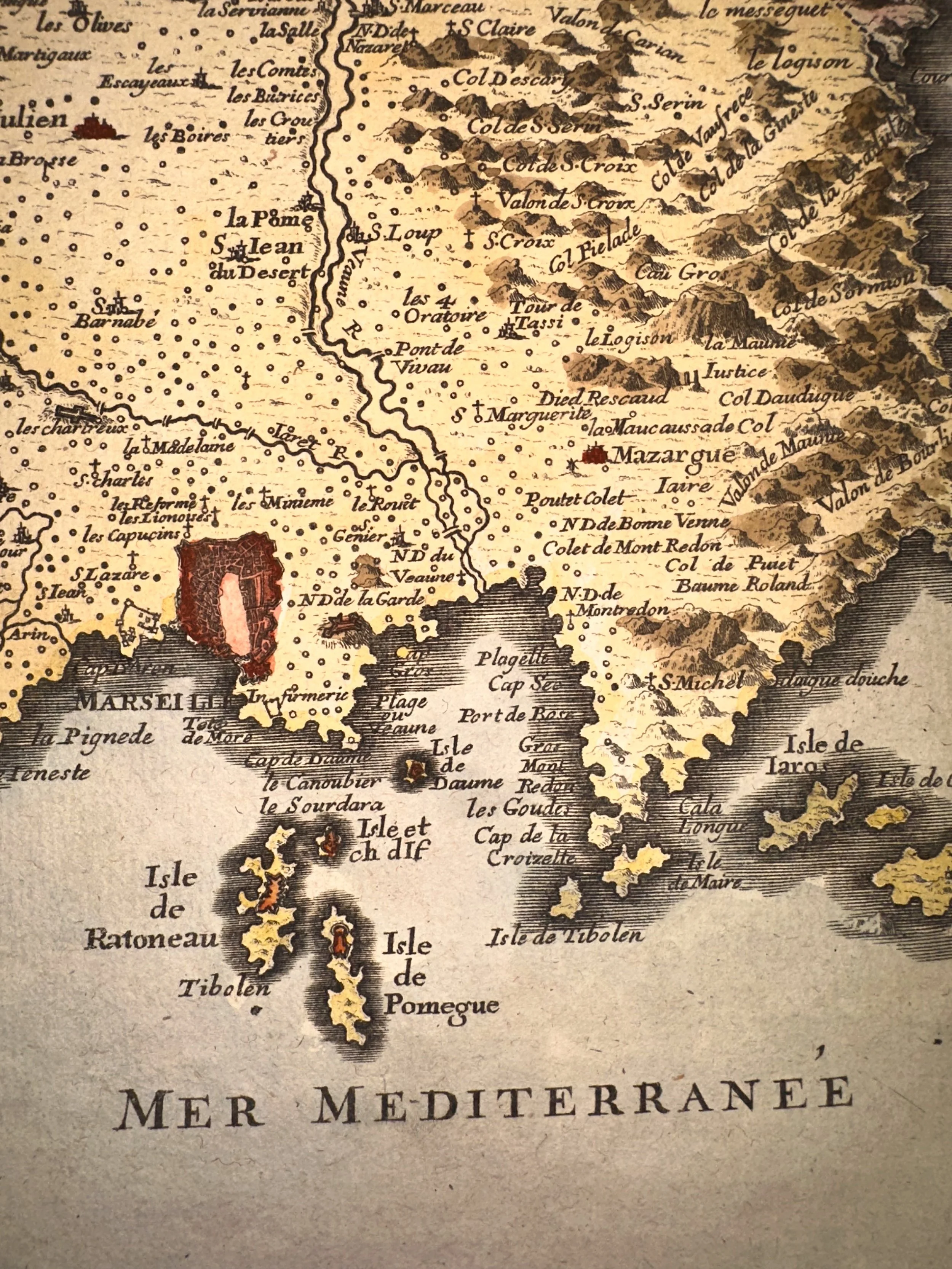
An exquisitely detailed plan of the ancient city of Pompeii as it appeared to early nineteenth-century eyes, freshly emerging from its entombment beneath the slopes of Vesuvius. Published in 1832 under the auspices of the Society for the Diffusion of Useful Knowledge by Baldwin & Craddock, and masterfully engraved by T.E. Nicholson, this cartographic work captures the wonder of one of archaeology’s greatest revelations. The key at the right carefully locates fifty-five principal buildings and monuments within the walled city. A finely rendered bird’s-eye view of the ruins, together with elevations of the major structures, graces the lower register, while elegant insets present a plan of the coast in the vicinity of Vesuvius and a detailed scroll rendering of the Domus Pansa, one of the most significant residences uncovered.
This beautiful example has been custom framed to museum standards in a solid wood frame with archival matting and foam-core backing. It is protected by premium UV-resistant acrylic glazing to safeguard against fading and environmental damage for generations to come. The refined blue matboard draws its inspiration from the vibrant cerulean tones of the Blue Room—a rare sacrarium recently excavated in Pompeii, its walls adorned with costly Egyptian blue frescoes depicting graceful female figures—thereby linking this nineteenth-century view of the ruins to the living artistic legacy still being uncovered today.
Pompeii, buried under thirty feet of volcanic ash and pumice during the catastrophic eruption of 79 AD, remained lost to history until its rediscovery in 1748. By the time this map was created, systematic excavations had already revealed a hauntingly preserved Roman city of streets, villas, temples, and theaters—offering an unparalleled window into daily life in the ancient world. This plan stands as both a precise scholarly document and a romantic evocation of classical antiquity, created at the height of the Grand Tour when European travelers flocked to witness the miracle of Pompeii for themselves.
Please review our Return Policy.
Title: “Pompeii”
Subject: Pompeii, Italy
Creator: SDUK Society for the Diffusion of Useful Knowledge
Date: 1832 (dated)
Map Size: 15.2 × 12.1 in | Framed Size: 22.25 × 19 in | Hand-colored
An exquisitely detailed plan of the ancient city of Pompeii as it appeared to early nineteenth-century eyes, freshly emerging from its entombment beneath the slopes of Vesuvius. Published in 1832 under the auspices of the Society for the Diffusion of Useful Knowledge by Baldwin & Craddock, and masterfully engraved by T.E. Nicholson, this cartographic work captures the wonder of one of archaeology’s greatest revelations. The key at the right carefully locates fifty-five principal buildings and monuments within the walled city. A finely rendered bird’s-eye view of the ruins, together with elevations of the major structures, graces the lower register, while elegant insets present a plan of the coast in the vicinity of Vesuvius and a detailed scroll rendering of the Domus Pansa, one of the most significant residences uncovered.
This beautiful example has been custom framed to museum standards in a solid wood frame with archival matting and foam-core backing. It is protected by premium UV-resistant acrylic glazing to safeguard against fading and environmental damage for generations to come. The refined blue matboard draws its inspiration from the vibrant cerulean tones of the Blue Room—a rare sacrarium recently excavated in Pompeii, its walls adorned with costly Egyptian blue frescoes depicting graceful female figures—thereby linking this nineteenth-century view of the ruins to the living artistic legacy still being uncovered today.
Pompeii, buried under thirty feet of volcanic ash and pumice during the catastrophic eruption of 79 AD, remained lost to history until its rediscovery in 1748. By the time this map was created, systematic excavations had already revealed a hauntingly preserved Roman city of streets, villas, temples, and theaters—offering an unparalleled window into daily life in the ancient world. This plan stands as both a precise scholarly document and a romantic evocation of classical antiquity, created at the height of the Grand Tour when European travelers flocked to witness the miracle of Pompeii for themselves.

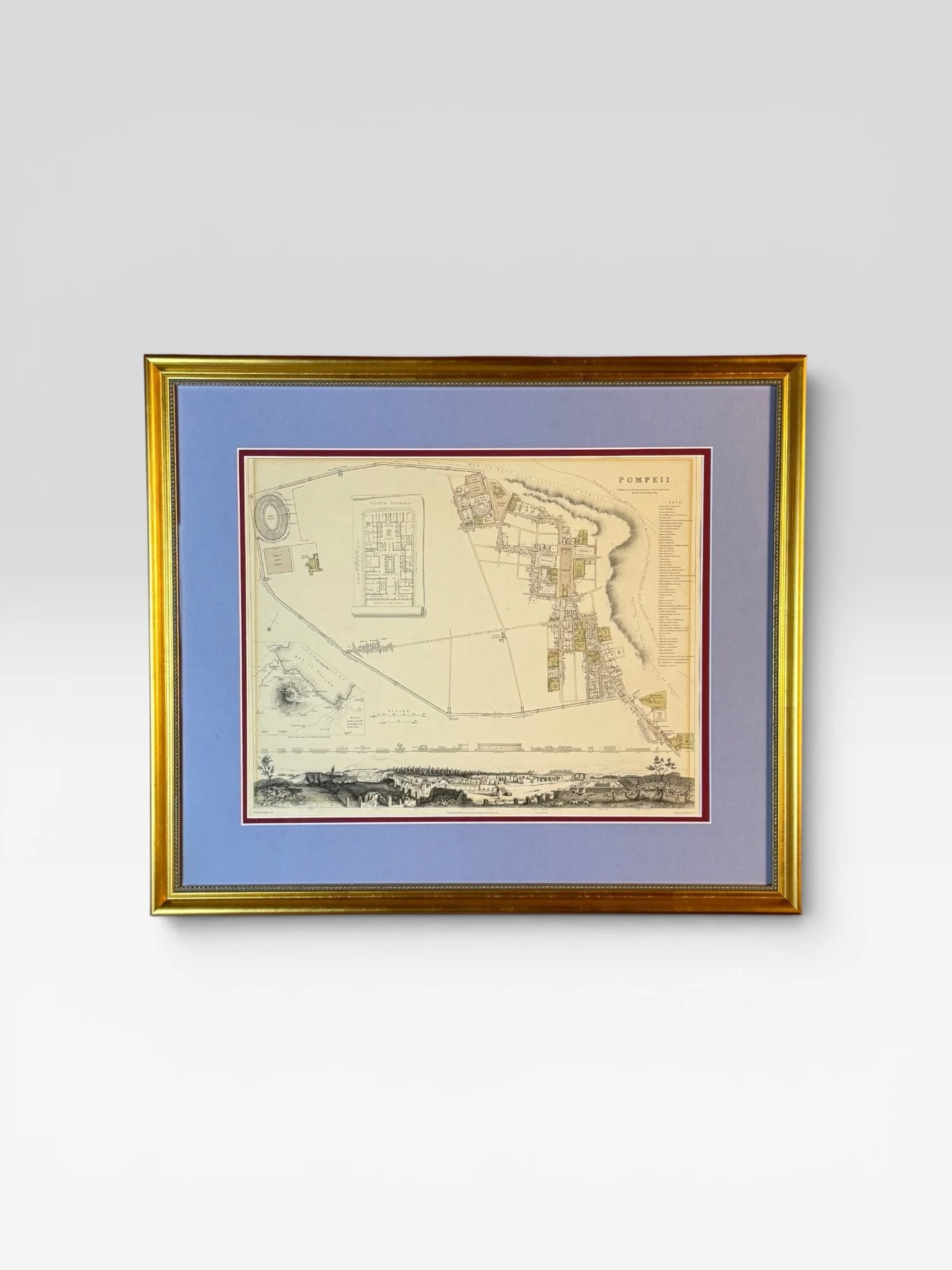 Image 1 of 8
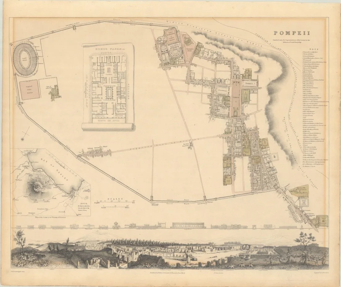 Image 2 of 8
 Image 3 of 8
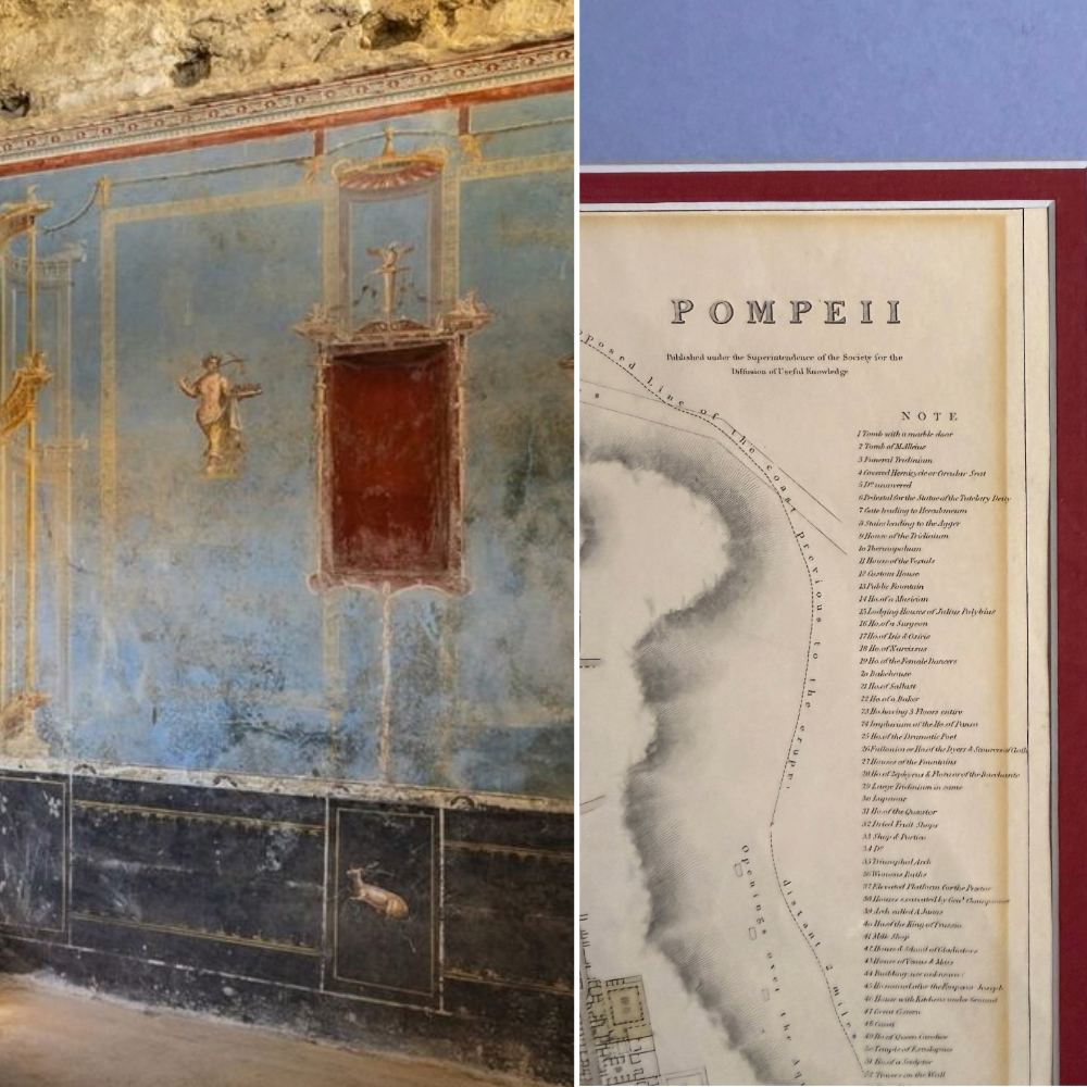 Image 4 of 8
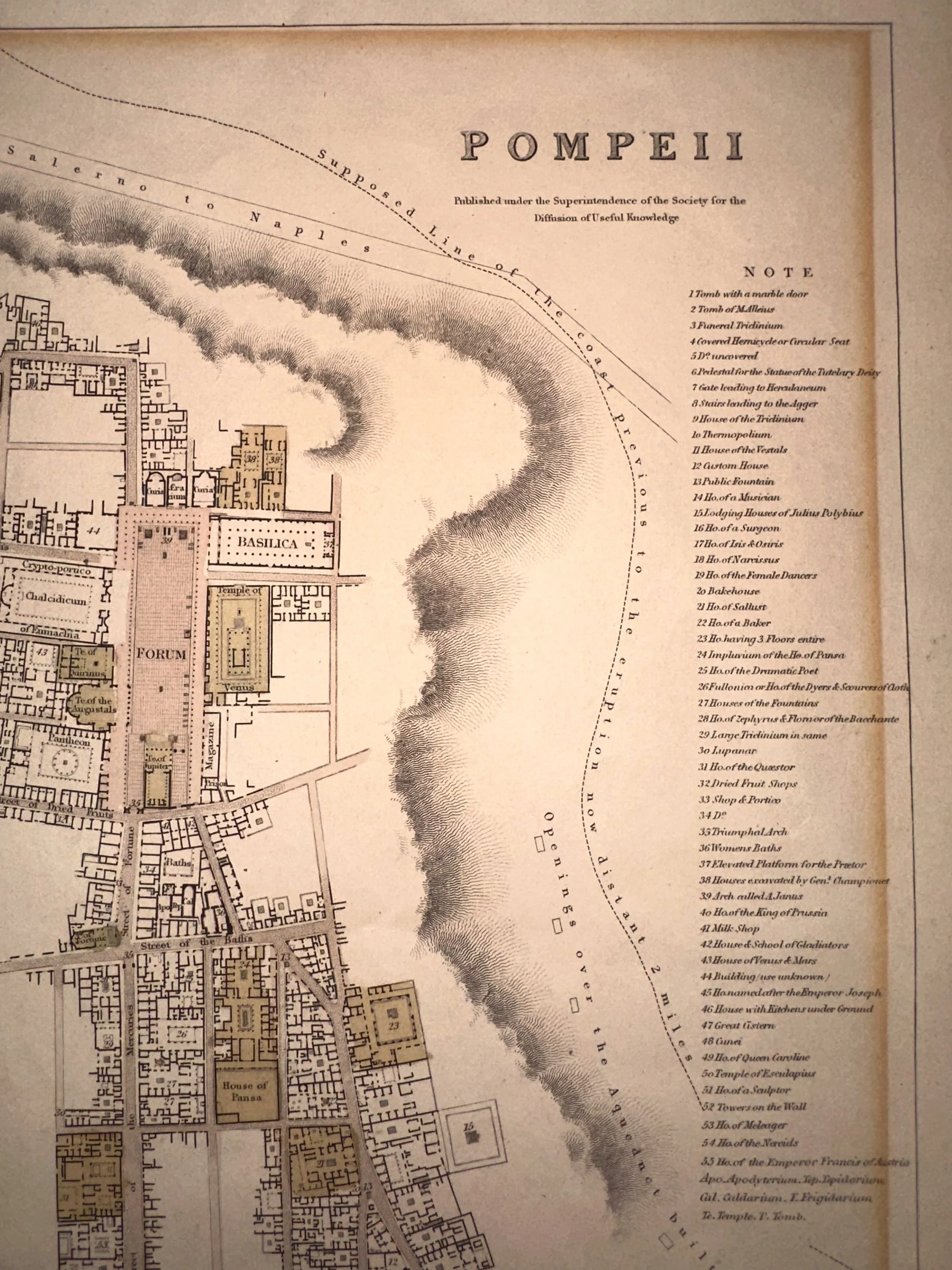 Image 5 of 8
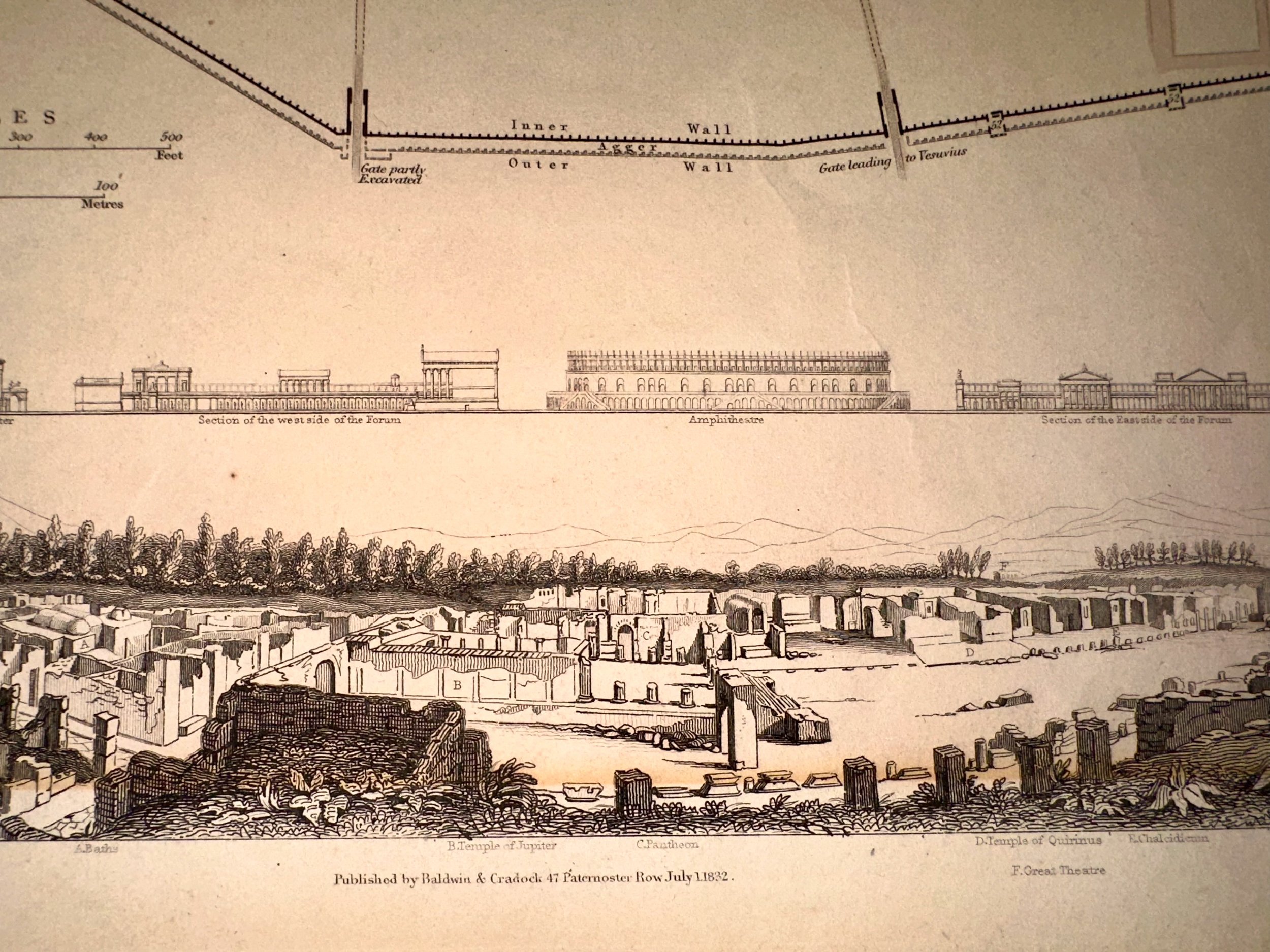 Image 6 of 8
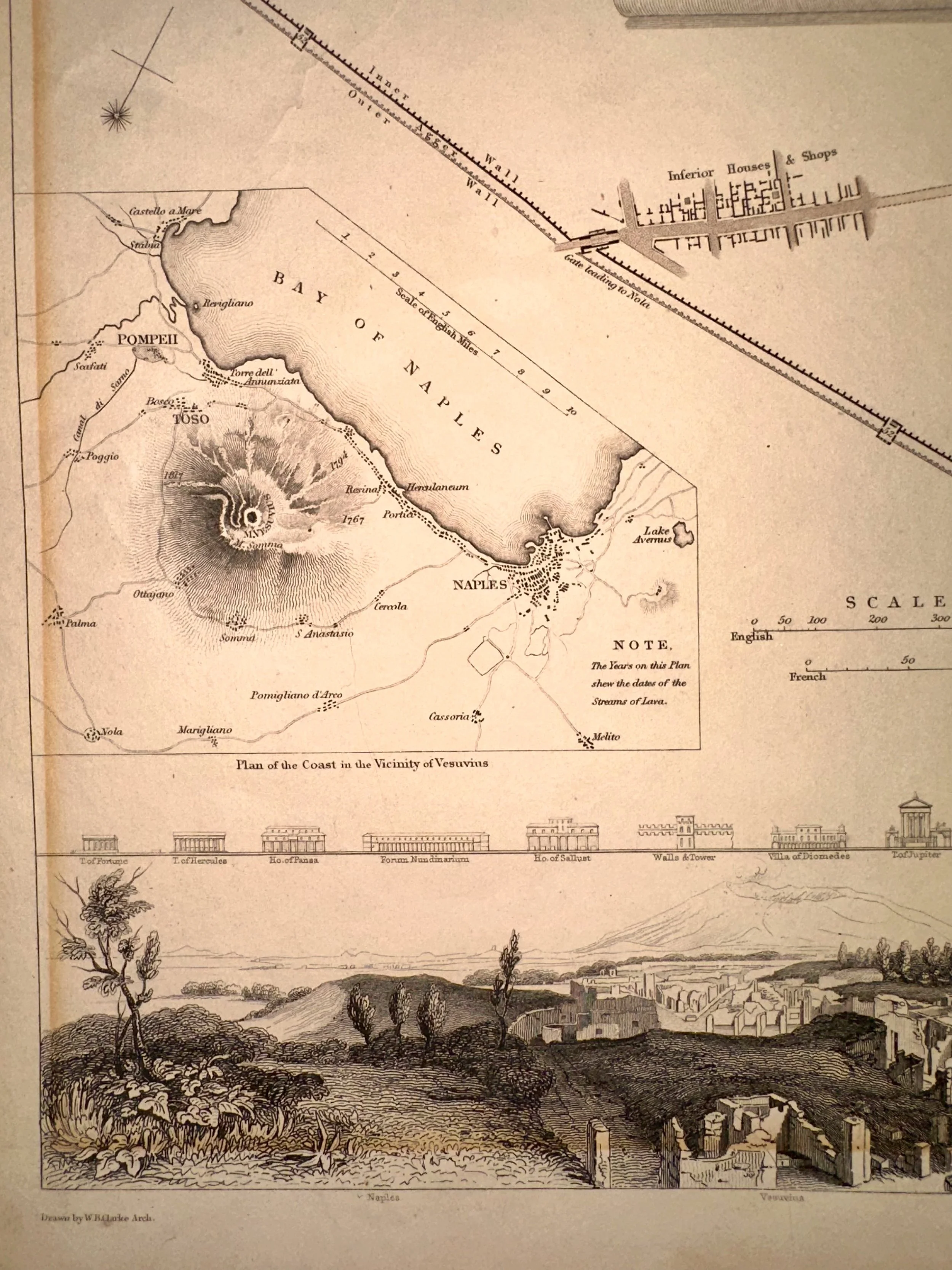 Image 7 of 8
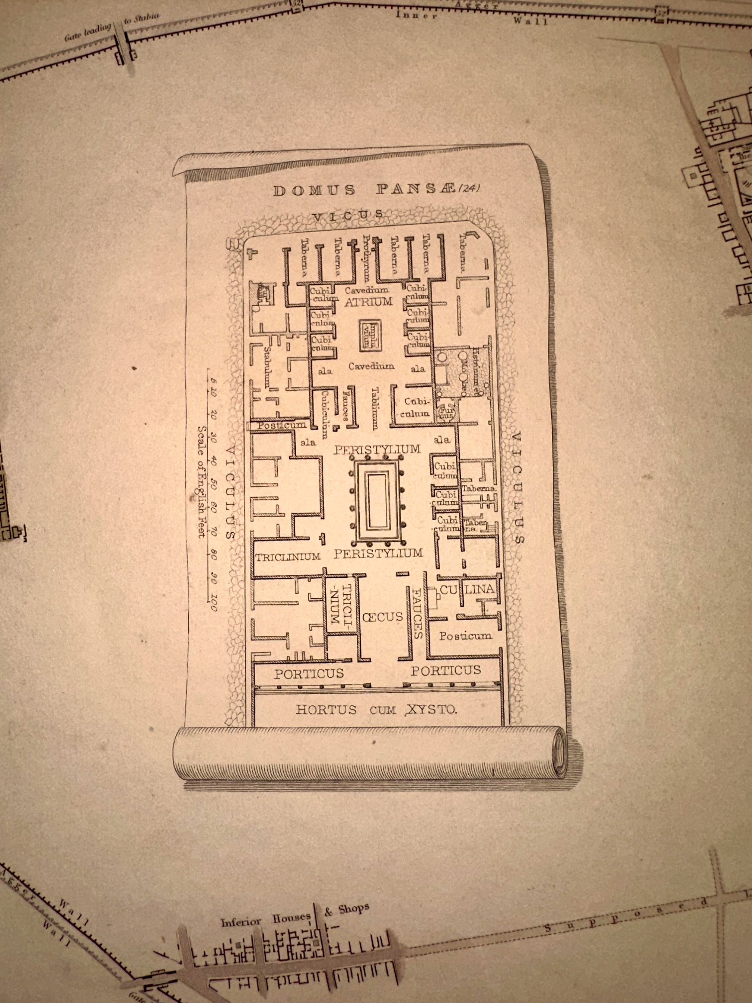 Image 8 of 8